Latest:
Feb 6 2013
M8 seafloor quake at the plate boundary angle between Solomon Islands and Vanuatu sets off a barrage of big aftershocks
Latitude 10-11S and longitude 165-66 affected
(Santa Cruz Islands region.)
Damaging tsunami effects in the focal region but no reports so far of extended tsunami effects.
Google Earth shows initial events, of which there were 27 (M4.9-M6.6) in the first 6 hours
Feb 7 2013
The aftershock sequence has resumed strongly in the Solomons seafloor region - after the triple -zero 3hr period of quiet so now the sequence of number of events per hour there is:
Feb 6 sequence = 2,0,7,5,8,4,6,3,1,5,3,3,3,2,2,2,2,0,0,0,2,3 (started from 01.12 hrs (UT)
Feb 7 sequence = 3,1,5,1,0,0,0,1,2,1,1,0,1,2,1,1,0,1,1,2,3,2,0,0
Feb 8 sequence = 2,0,1,0,3,2,0,2,3,3,0,4,2,2,2,5,0,1,2,1,1,0,1,2Nearby: Tonga, Papua New Guinea, Indonesia have all had quakes over M4 in the 3 days since the Solomons seismic unrest, making this section of the Pacific Ring of Fire the current global hot spot
Data: USGS
Feb 11 2013
Over 150 aftershocks of M4+ and up to M7.1 have occurred in the Solomons region since Feb 6
Jan 11 2012
Including here, due to potential regional impact, events in Indonesia, specifically today a M7.3 quake off Banda Aceh Sumatra, which was a strike slip, horizontal event and therefore less capable of tsunami generation. A very useful geological paper as a PDF resource exists, with hi-res graphics appended, for those interested in a study following the devastating 2004 Boxing Day quake & tsunami in the same zone. Sample graphic. click to enlarge all graphics
Jan 6 2012
strong seafloor quakes in past 6 months
Also M5 Pegasus Bay off Chch Jan 6 2012
Jan 3 2012
Ongoing quake unrest offshore from Christchurch New Zealand increases the reputation of this south Pacific zone. Westwards movement of the Pacific plate and uplift of the Australian plate could be showing a stress point in the Christchurch zone of NZ.
 |
| NOAA graphic shows the continental shelf NZ sits on CLICK TO ENLARGE all graphics |
 |
| LINZ graphic detail of rises, ridges, plateaux, trenches and basins |
 |
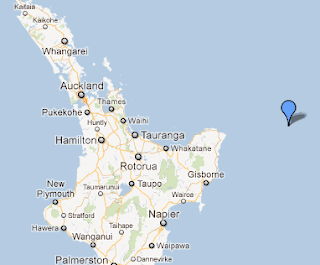
| PLATE BOUNDARY n/e of NZ |
UK university researchers have been paying a lot of attention to the Tonga Trench, said to be the most seismically active zone on the planet -and the second deepest ocean zone, which like in the more northern and deeper -in fact earth's deepest - the Mariana Trench at around 12N of the equator features a chain of undersea volcanoes which are on a path westwards, subducting under the adjacent tectonic plate and both regions are showing the descent of the volcanic mounds into the trench below. Fascinating stuff, but also rather scary, in that this amount of activity and the research being applied, indicates that the global scientific community is very aware of the fragile era of tectonic upheaval facing many areas of the globe. Long overdue readjustments are on the cards -and the influence of planetary stress factors - especially at the moment the cycle phase of Pluto and Uranus - in the larger scheme of things indicates that in our lifetime there is cause for concern.
Japan of course has had its wake-up call in 2011 - as has New Zealand since September 2010 and with the seismic factors considered both countries remain in the at risk category for further destructive events. Of course the South Pacific island nations including Samoa, Fiji and Tonga are living in very vulnerable region.
 | |||
| Larger view with some Red Dot volcanoes maked |
TE ARA graphic of the plate boundary
The fault map shown with Geonet NZ graphic of most recent quakes prior to Dec 13 2011
Clearly the plate boundary is very active
The South Island of NZ is positioned on top of the Pacific plate boundary with the Australian plate and this convergence created the Southern Alps. Of NZ's four main cities, only 2 - Auckland the northern economic hub and Dunedin, in the much quieter deep south, are distanced from the boundary itself.
New Zealand authorities are showing a sudden significant response to earthquake hazards, some 10 months after the destructive Christchurch quake in February 2011. A string of public buildings have been closed in recent weeks across the country due to being designated as earthquake prone. Many are heritage or tend to be older unreinforced masonry constructions.
It could be assumed from this increased sense of public protection, that the authorities in New Zealand have ben very clearly advised of ongoing hazards being anticipated from the seismic vulnerability of New Zealand.
Reference
BBC report on the Tonga Trench research in 2011


No comments:
Post a Comment